

Early forecast predicts 4-7 hurricanes this season
While the official start to the Atlantic hurricane season doesn’t start until June 1, top forecasters have already released their predictions for the upcoming season.
According to AccuWeather, the 2026 season is expected to fall below the 10-year average for both total storms and hurricanes, even at the higher end of AccuWeather’s forecast.
“It’s very important that everybody from South Texas all the way to Maine prepares equally for each and every hurricane season, regardless of the forecast,” said AccuWeather Lead Hurricane Expert Alex DaSilva in a release. “Even if it’s expected to be a slightly below average hurricane season, we can still see major hits across the United States.”
All-in-all, AccuWeather is forecasting 11 to 16 named storms, with four to seven being hurricanes. Of those four to seven, AccuWeather is predicting to two to four will be “major” hurricanes, or storms that are Category 3 or higher. As for direct impacts to the U.S., AccuWeather experts are forecasting three to five total, with the central and eastern Gulf Coast noted as areas with higher-than-historical-average risk of “significant” tropical impacts this year.
As always, hurricane activity comes down to the presence of El Niño, which is a natural climate pattern characterized by the warming of ocean surface temperatures in the central and eastern tropical Pacific Ocean.
AccuWeather experts expect El Niño to increase disruptive wind shear and reduce storm activity, most notably later on in the season. Long-range experts of AccuWeather state there is a 15% chance of a “Super El Niño” developing in the second half of the hurricane season.
“If a Super El Niño occurs, there could be even less activity in the Atlantic,” experts stated.
Another factor going into the season could be exceptionally warm Atlantic waters.
“Water temperatures across much of the Gulf, Caribbean and Atlantic are forecast to reach exceptionally warm levels again this summer. That heat extends hundreds of feet below the surface, providing additional fuel for storms,” DaSilva said. “As a result, we are very concerned about the risk of rapid intensification this hurricane season.”
When it comes to U.S. landfall potential, experts state that storms may form in the Gulf, western Caribbean, or western Atlantic off the Southeast coast. When storms develop near the states, there is less time for those facing impacts to prepare.
“Storms that form within a few hundred miles of the coast can leave people, businesses, and officials with less time to prepare and evacuate,” DaSilva explained. “These ‘homegrown development’ storms that spin up near the U.S. coast can pose bigger threats with a lot less time to react, compared to storms that form off the coast of Africa and take a week or more to trek across the open Atlantic.”
AccuWeather experts warn of complacency, especially following a year that did not see a hurricane make landfall in the U.S.
“There is no reason to let your guard down this year. It only takes one storm to cause major damage, disruption and heartache,” DaSilva said. “Review your insurance coverage, safety plans, and local evacuation routes now. Make sure your emergency supplies are stocked up.”
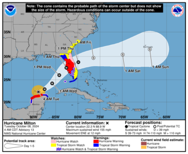
Meanwhile, among its improvements for the 2026 hurricane season, NOAA’s National Hurricane Center is implementing what it says is an improved hurricane track cone map.
“The tropical cyclone graphic helps communities remain vigilant from the dangers posed by wind hazards associated with hurricanes and tropical storms, including in locations away from the coast,” the National Oceanic and Atmospheric Administration said on a release issued Tuesday. “In 2026, the forecast cone will now include tropical storm and hurricane watches and warnings for inland areas. The additional information follows a successful experimental phase last year, which demonstrated the improved forecast cone enabled inland communities to better understand and prepare for the danger posed by tropical cyclone winds.”
According to the National Hurricane Center release, the new cone graphic:
• Incorporates all land-based (coastal and inland) tropical storm and hurricane watches and warnings in effect for the continental United States, Hawaii, Puerto Rico, and the U.S. Virgin Islands;
• Uses single shading for the entire 5-day outlook cone;
• Legend depicts symbols for areas where a hurricane watch and tropical storm warning are both in effect (represented by diagonal pink and blue lines);
• Full and intermediate Tropical Cyclone Advisories are/will be publicly available on hurricanes.gov.
NHC also will introduce a new experimental version of the NHC’s Tropical Cyclone Track Forecast Cone, the release states. Since its debut in 2002, the cone has shown where the tropical cyclone’s forecast center is likely to go, based on past forecast calculations.